

Meall nan Tarmachan South Top [Meall nan Tarmachan SE Top]
Good walks are even better shared.
NN5838 : Looking down the southeast ridge of Meall nan Tarmachan
Doug Lee Photo source
Overview
Meall nan Tarmachan South Top
Nestled in the rugged beauty of the Scottish Highlands, Meall nan Tarmachan South Top stands as a worthy challenge for any enthusiast of the great outdoors. At an elevation of 926 meters, this Munro may not be the highest of its kin, but it certainly charms with distinct character and spectacular views.
Geology
The mountain is primarily composed of ancient metamorphic rock, a testament to the powerful geological forces that have shaped the skyline. As you ascend, keep an eye out for unique rock formations, reminders of the ice age that sculpted these lands.
Routes
One of the most popular routes is the Tarmachan Ridge Circuit, measuring approximately 11.2 km in length and taking about 5.5 hours to complete. This challenging trek rewards hikers with breathtaking views while winding along the dramatic ridge.
Summit Features
Upon reaching the summit, you'll be greeted by a humble cairn and an array of breathtaking vistas that stretch across the Highland landscape, attracting both amateur and seasoned photographers alike.
Terrain Type
Expect a mix of rocky outcrops and grassy slopes, interspersed with damp areas that could have you skipping around like a frog on a hot plate. Proper footwear is essential—best not to bring your grandmother's slippers along!
Views
From the summit, the sights are absolutely magnificent. Whether you're gazing at the shimmering Loch Tay or the majestic peaks of the surrounding Munros, every glance is a postcard moment. Late spring through early autumn are the prime seasons to visit, benefiting from clear skies and blooming flora.
Hazards
As beautiful as it is treacherous, be wary of steep and rocky sections as well as the potential for slippery stones in wet conditions. A fall could lead you on an unplanned adventure, and not the kind you want!
Nearby Summits
If you have the energy, consider tackling additional nearby Munros such as the impressive Ben Lawers or its sibling, the grand Meall nan Tarmachan.
Access
The best way to access this highland gem is by parking at the Ben Lawers Visitor Centre. From here, you can embark on your journey. There is also public transport available to nearby villages such as Killin, which is the closest town where you can stock up on snacks and water.
Facilities
To make your trek even more pleasant, be sure to visit the visitor centre, where you’ll find essential facilities including toilets and a delightful little café to recharge your batteries before or after your hike.
History
In terms of history, the mountain's name reflects its ties to the local wildlife—the elusive ptarmigan can be spotted if you're lucky! The area is steeped in tales from the early settlers, with remnants of their culture adding an extra layer of intrigue to your hike.
Embarking on this hike is not just about the destination, but the journey itself. So lace up those hiking boots and get ready for an adventure that is sure to leave you with memories to last a lifetime!
Note: Remember to leave no trace, respect nature, and above all—have fun!
Explore routes near Meall nan Tarmachan South Top [Meall nan Tarmachan SE Top]
Walks starting near this hill. Open a route to check its map, distance and full itinerary.
Killin: Falls of Dochart, Finlarig and Moirlanich Longhouse
View route
Kenmore: Drummond Hill Black Rock Trail above Loch Tay
View route
Aberfeldy: Glassie Woodland and River Tay Circular
View route
Loch Lubnaig: West Shore Railway Path from Ben Ledi Car Park
View route
Route planning notes
These notes describe possible approaches. Check a route's map and access information when planning your walk.
Tarmachan Ridge Circuit
A scenic route that takes you along the striking Tarmachan Ridge, providing stunning views of surrounding peaks and Loch Tay.
Make a day of it, together
Find someone to share the walk with, or organise a day out along a route you like.
Photo Gallery
View all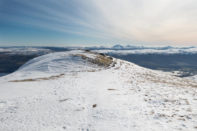 Photo could not load
NN5838 : Looking down the southeast ridge of Meall nan Tarmachan
Doug Lee
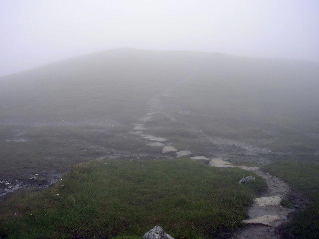 Photo could not load
NN5838 : The Bealach between spot Height 923m and Meall nan Tarmachan
Iain Lees
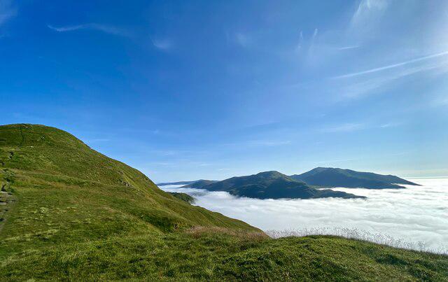 Photo could not load
NN5838 : Inversion on Meall nan Tarmachan
Iain Lees
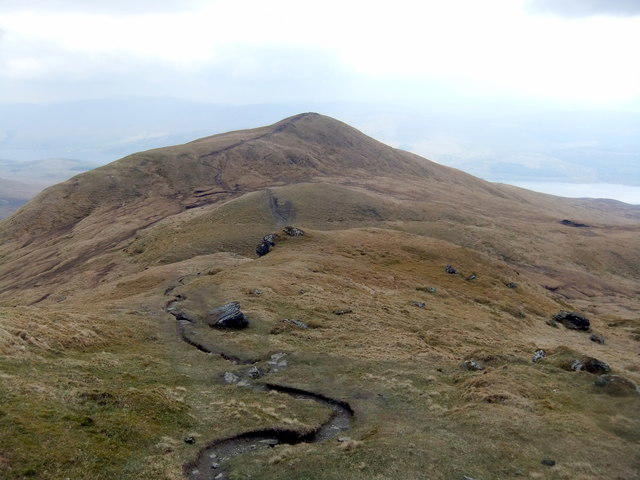 Photo could not load
NN5838 : SE top of Meall nan Tarmachan
David Brown
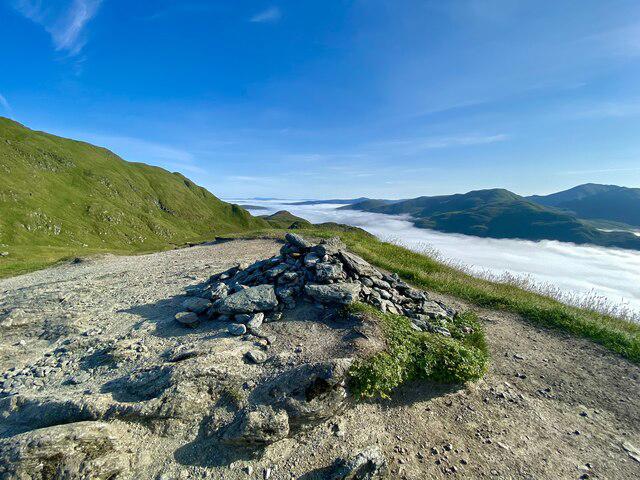 Photo could not load
NN5838 : The Cairn at 923m on Meall nan Tarmachan
Iain Lees
Hill facts and local notes
Classifications
Elevation
922m
3,024 ft
Prominence
32m
Coordinates
56.5174, -4.2944
NN589385
OS Map
51
Explorer: OL48E 378E
At the Summit
The summit features a small cairn and offers panoramic views of the surrounding mountains and valleys.
Terrain & Geology
The mountain is predominantly composed of ancient metamorphic rock, part of the Grampian Mountains range. Its rugged terrain has been shaped by glacial activity, offering a fascinating glimpse into the geological forces that have shaped this beautiful part of Scotland.
Views & Scenery
From the summit, you can see Loch Tay to the north and a sweeping panorama of the surrounding Munros such as Ben Lawers and An Stuc.
History & Heritage
Name Origin
The name 'Meall nan Tarmachan' is derived from Gaelic, meaning 'Hill of the Ptarmigan'.
Historical Significance
This area is rich in both natural history and cultural significance, previously inhabited by early settlers who left traces of their presence.
Getting There & Facilities
Parking
Parking is available at the Ben Lawers Visitor Centre (NN579372), which provides a good starting point for the hike.
Public Transport
The nearest bus stop is in the village of Killin, from which local taxis can be arranged to the visitor centre.
Nearby Facilities
The Ben Lawers Visitor Centre offers toilets and a small café with refreshments to fuel your adventure.
Safety Information
Known Hazards
- Steep, rocky sections that require careful navigation. Loose stones can be slippery, particularly in wet conditions.
General Safety Tips
- Check weather conditions before setting out
- Carry appropriate clothing and equipment
- Let someone know your planned route
- Take a map, compass, and GPS device
- Carry emergency supplies: food, water, first aid kit, torch
Hills
Some common questions about the hills answered
Are there group walks up Meall nan Tarmachan South Top [Meall nan Tarmachan SE Top]?
Many walkers use Walkmates to join or organise walks with others. You can check for group walks around Meall nan Tarmachan South Top [Meall nan Tarmachan SE Top] through the maps
Are there other walkers around Meall nan Tarmachan South Top [Meall nan Tarmachan SE Top]?
Activity varies by location and time, but Walkmates lets you see whether others have shared walks or shown interest in this area. Find other people through the walking friends search walking friends for Meall nan Tarmachan South Top [Meall nan Tarmachan SE Top] search or of course create your own walk for Meall nan Tarmachan South Top [Meall nan Tarmachan SE Top]
Can I organise a walk to Meall nan Tarmachan South Top [Meall nan Tarmachan SE Top]?
Yes. If there aren’t any walks listed already, you can create a walk and make it available for others to join.
If you're signed up to Walkmates, you can create a walk to Meall nan Tarmachan South Top [Meall nan Tarmachan SE Top].
How do I find a walk up this hill?
There are often multiple ways to walk this hill, depending on experience and route preference. Walkmates helps you explore walks and routes that others have shared.
Can I suggest a new route up Meall nan Tarmachan South Top [Meall nan Tarmachan SE Top]?
Yes. You can suggest or create routes to share with others. Walkmates focuses on the social side of walking, so routes are used to help people organise walks and explore areas together, rather than as detailed navigation tools or route libraries.
Other uses really appreciate knowledgeable walkers sharing their routes. Share your favourite route to Meall nan Tarmachan South Top [Meall nan Tarmachan SE Top] here
The is an error or something incorrect about this hill. How do I let you know?
We always strive to keep the information on Walkmates as accurate as possible. If you find an error, please let us know through the contact form and we'll aim to correct it as quickly as possible
Community Discussion
Comments
Location
![Meall nan Tarmachan South Top [Meall nan Tarmachan SE Top] location map](https://cdn.walkmates.com/hill-maps/hill-sources/164/56.51741_-4.29444.png)
Grid reference: NN589385
View on OpenStreetMapOpens a map in a new tab, centred on the hill.


No comments yet. Be the first.